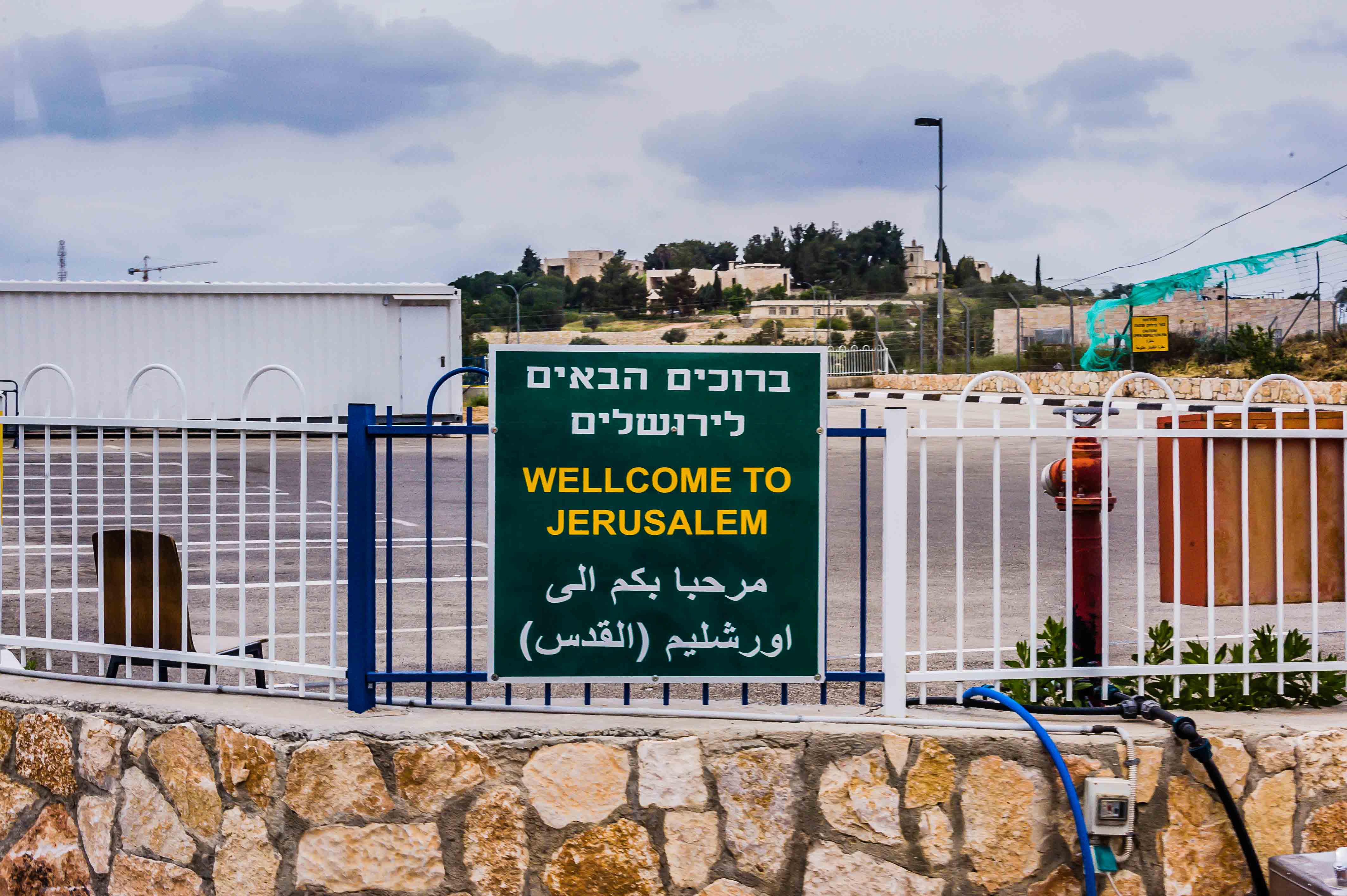
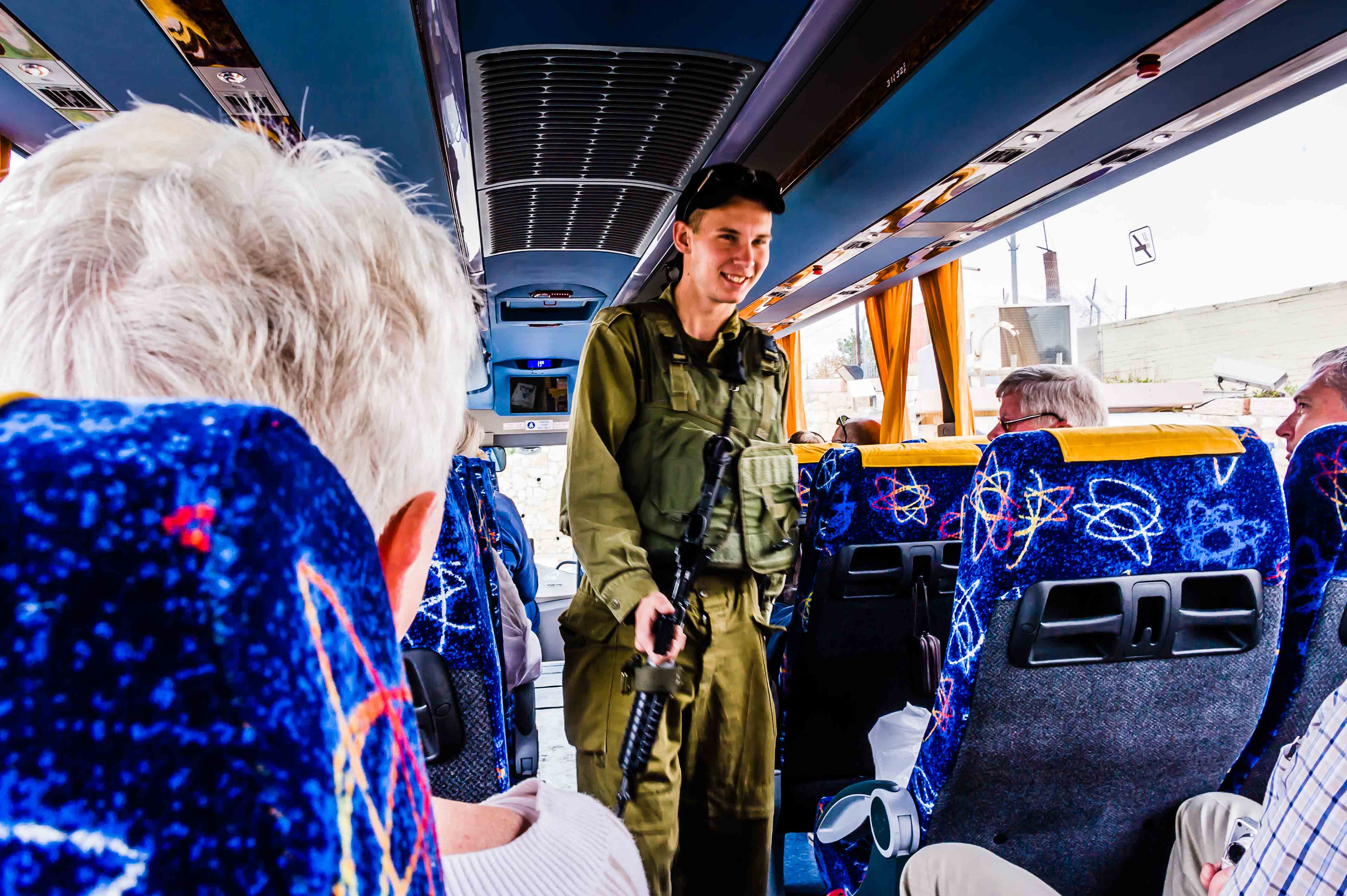
Today we are in Israel where we will have a tour to both Jerusalem and Bethlehem.  It will be a full day for sure.  We boarded our bus from Ashdod Port at 8:15 am and took the 90 minute drive to Jerusalem.  Today is the last day of Passover, which our guide said was lucky because there was little traffic going into the city.

Israel, officially the State of Israel, is a parliamentary republic in the Middle East, along the eastern shore of the Mediterranean Sea. It shares borders with Lebanon, Syria, Jordan, West Bank, Egypt and the Gaza Strip.  Israel is defined as a Jewish and Democratic State in its Basic Laws and is the world’s only Jewish-majority state.

The population of Israel was estimated in 2012 to be 7.8 million people, of whom approximately 6 million are Jewish. Arabs form the country’s 2nd largest ethnic group, the great majority of whom are Muslims.  As you know, Israel has an amazing history, too much for this post, but please check it out when you get a chance on Wikipedia.

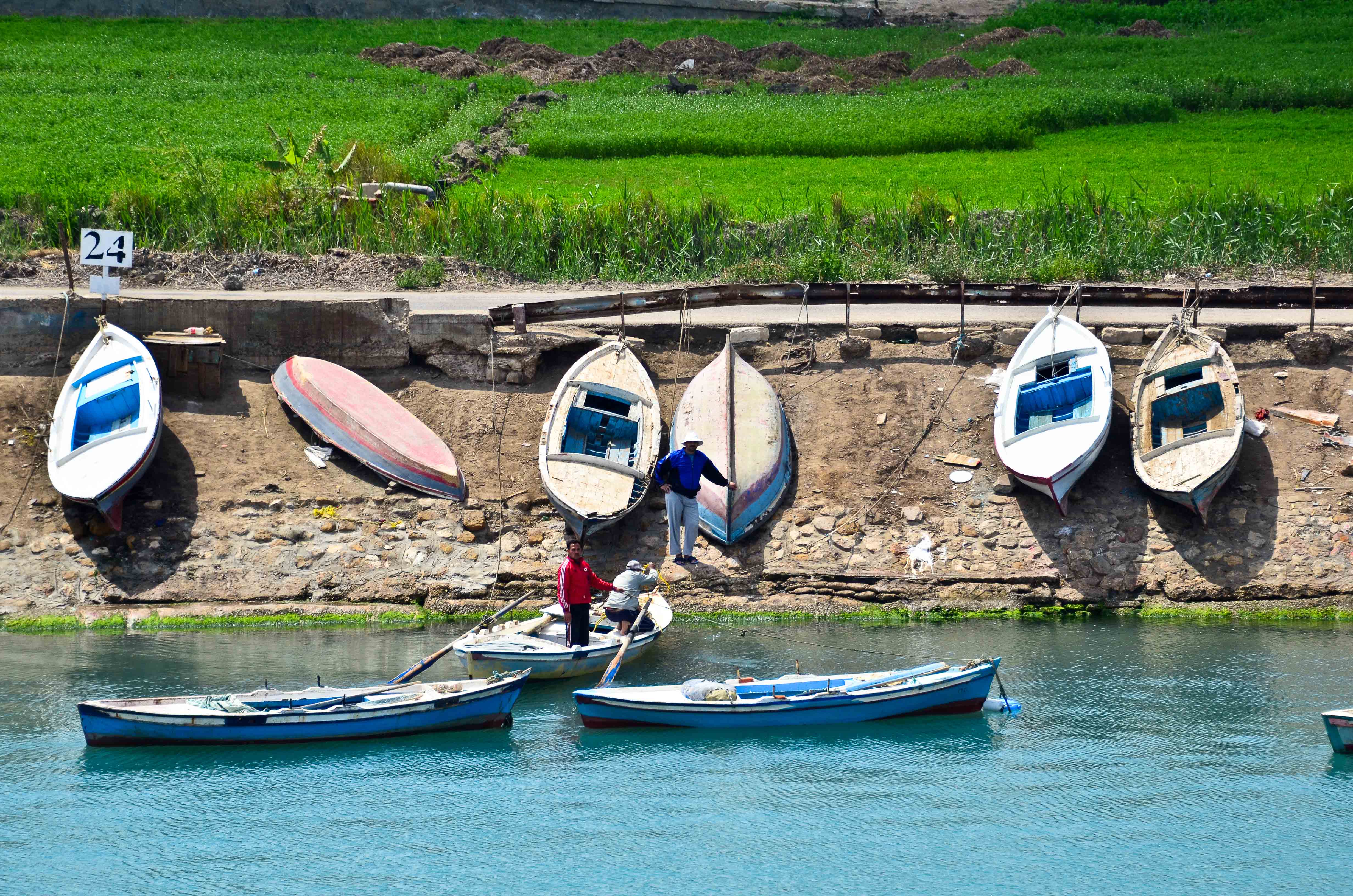
The first thing that struck us is the beauty of the Israel countryside.  It is green, filled with agriculture, wild flowers and beautiful rolling hills.  Our guide, Ahran, told us that Israel has an extensive desalinization program in place where they take the salt out of ocean water in order to produce fresh water that is suitable for human consumption and irrigation.

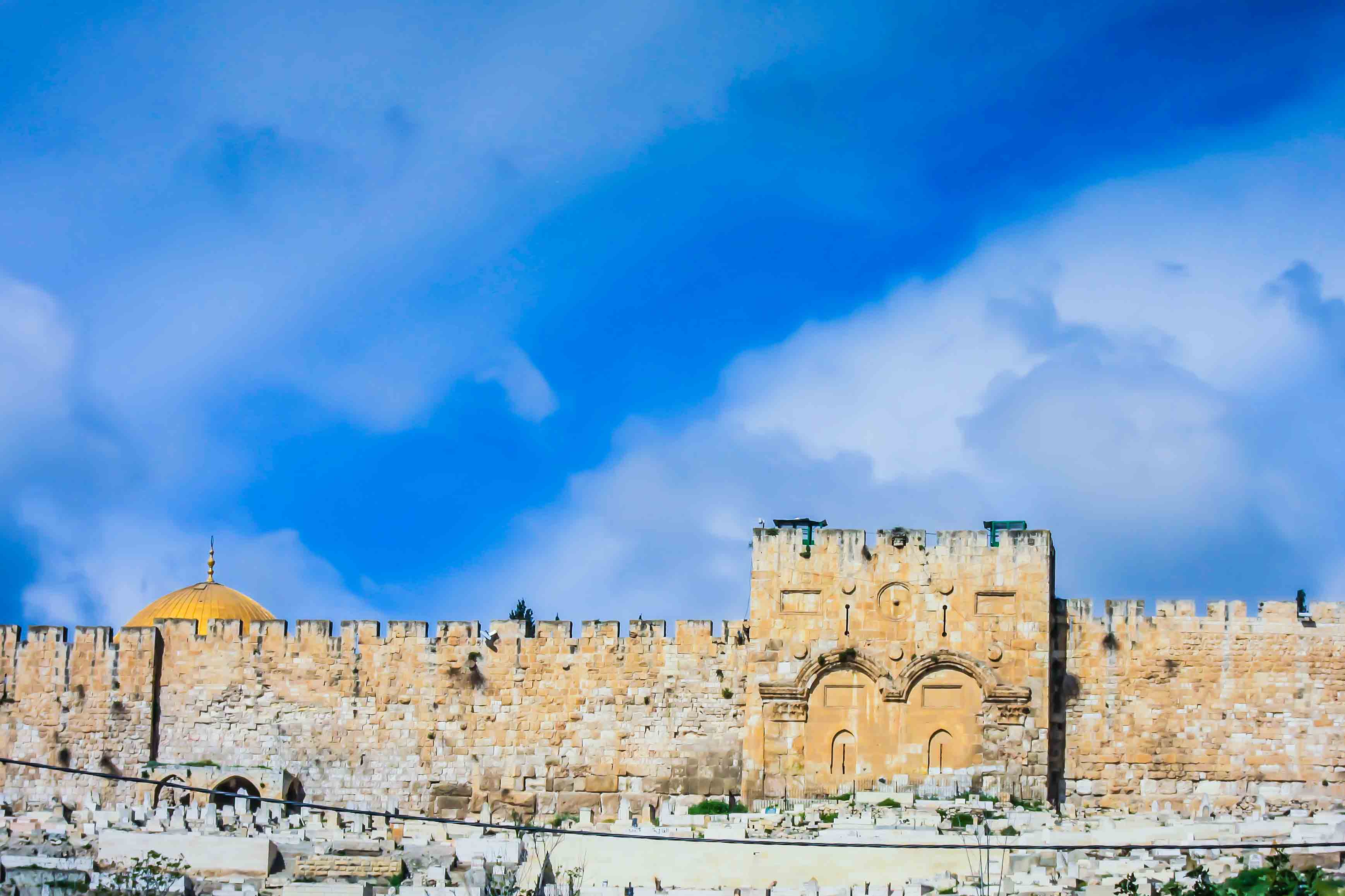
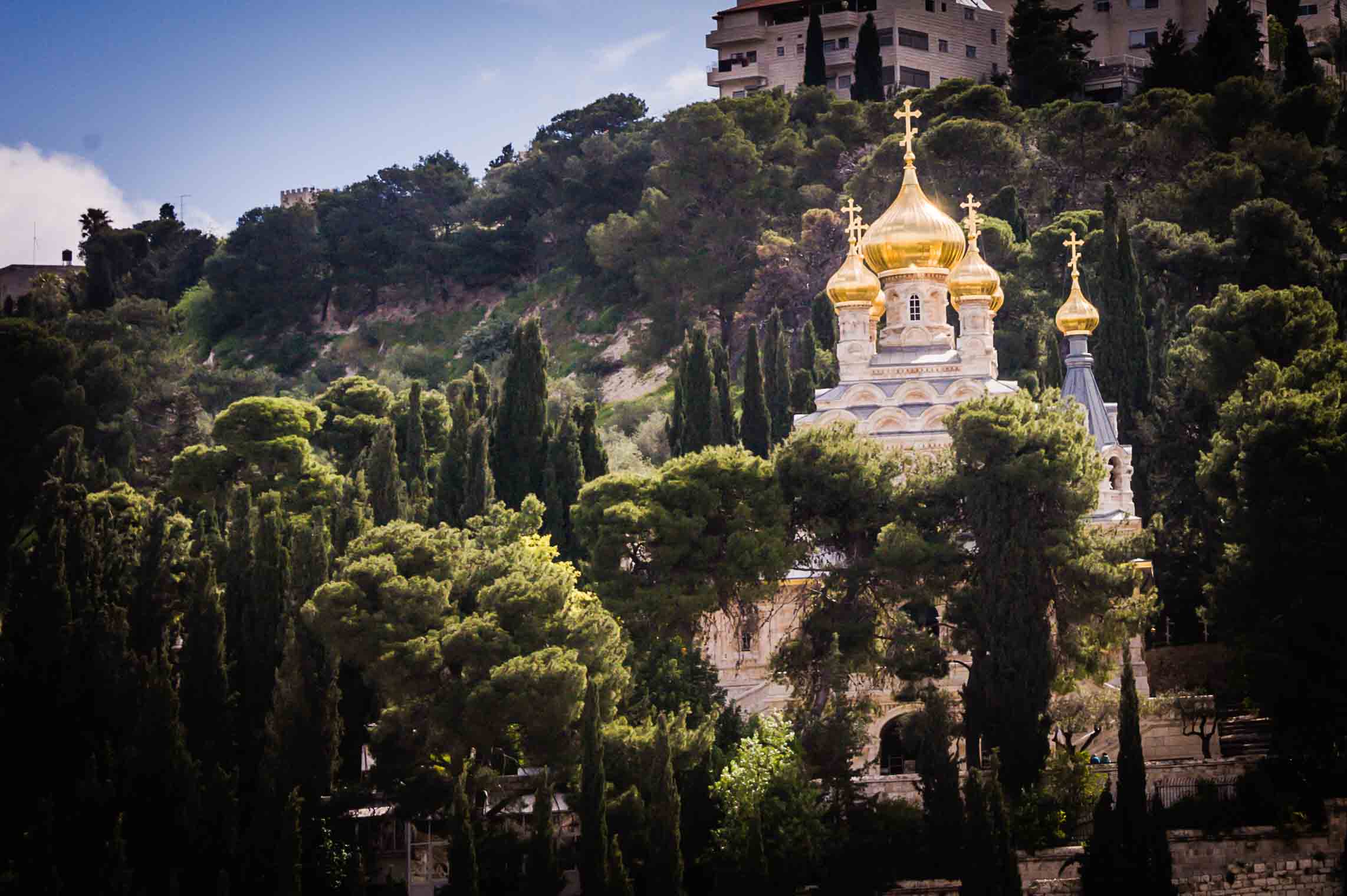
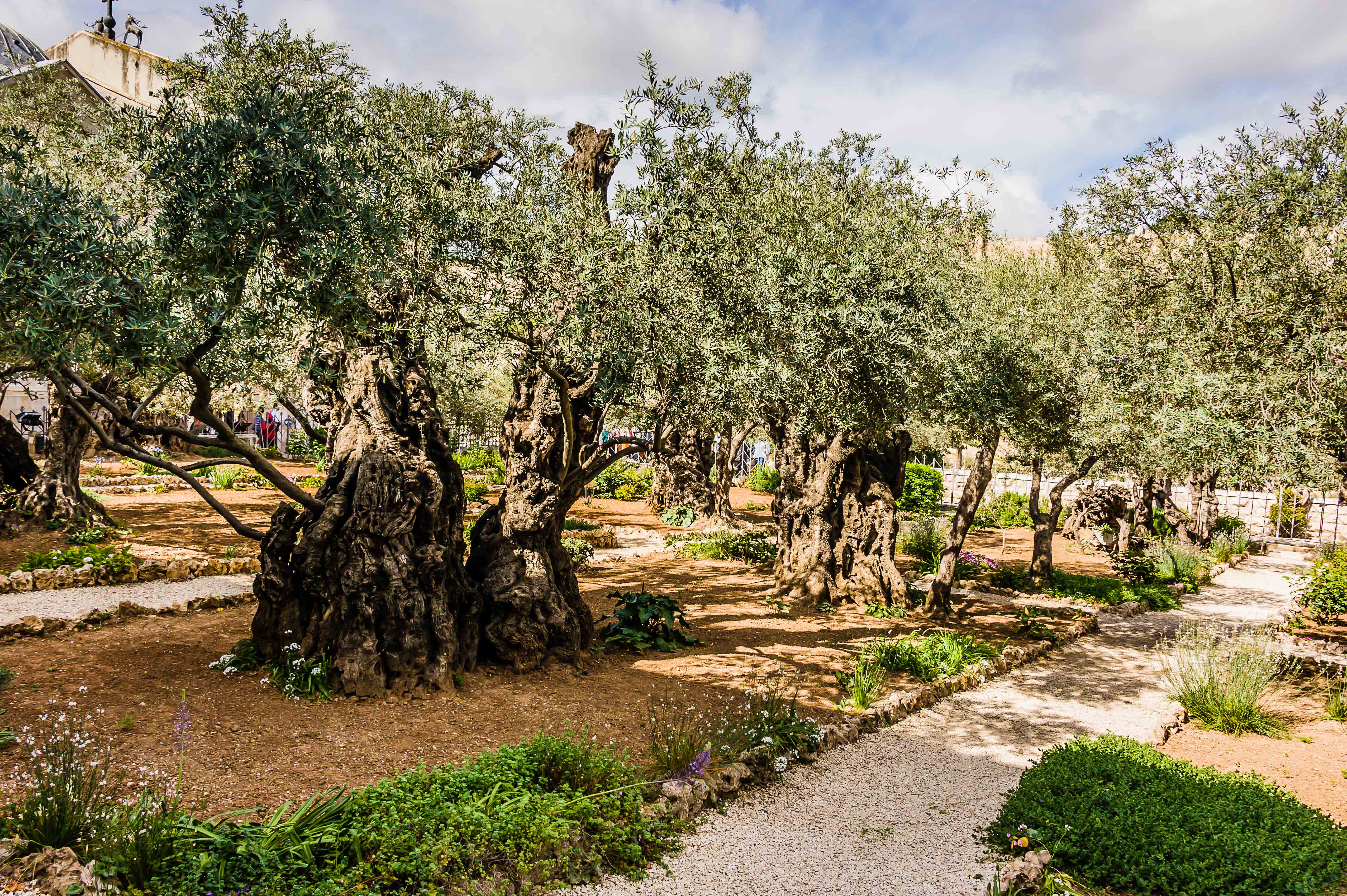
Our first stop was the Mount of Olives for a panoramic view of the old city of Jerusalem.  We then made our way down to visit the Garden of Gethsemane and the Church of all Nations.

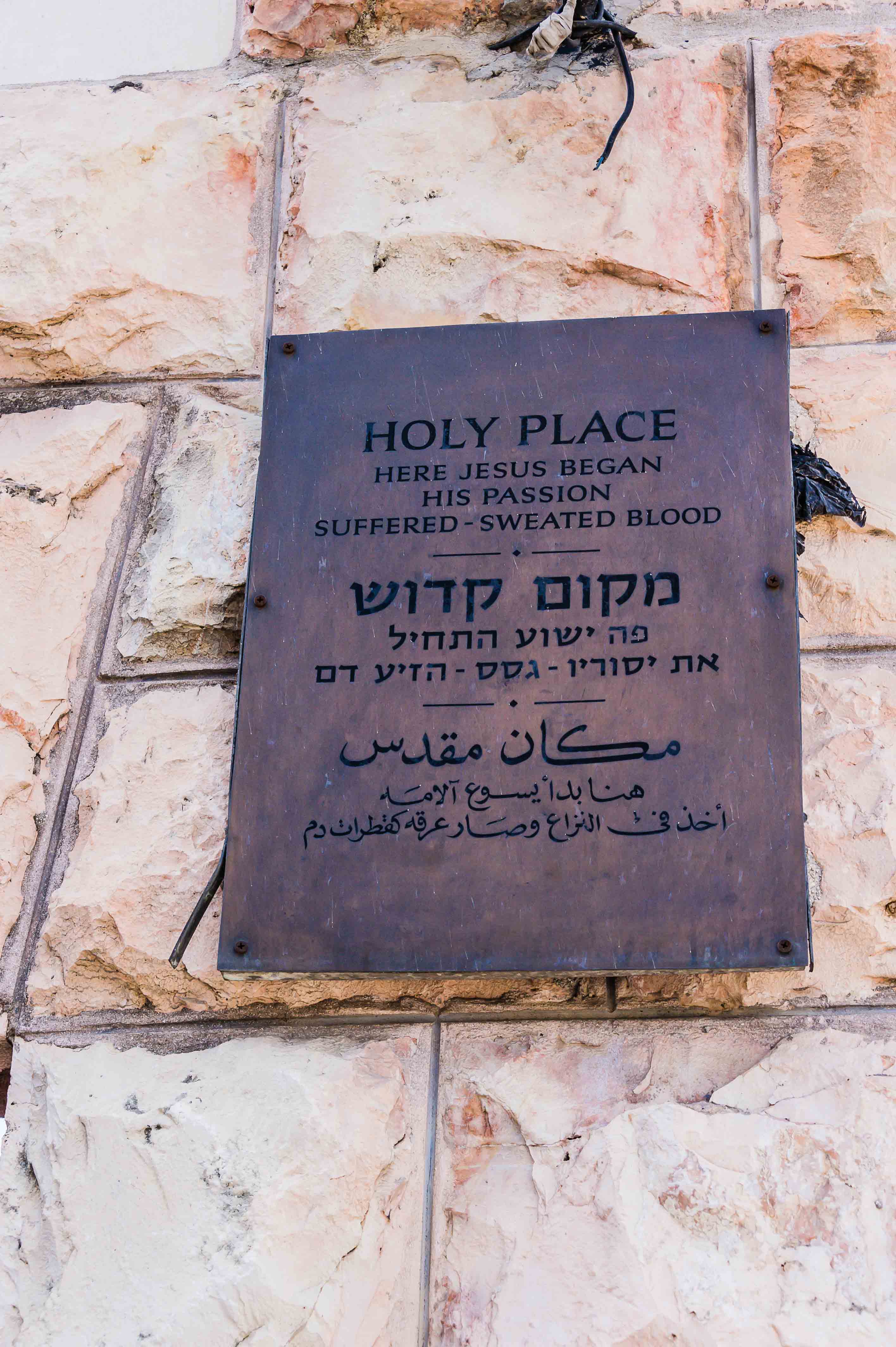
The Garden of Gethsemane is a garden at the foot of the Mount of Olives most famous as the place where, according to the gospels, Jesus and his disciples prayed the night before Jesus’ crucifixion.  Some of the olive trees found in the garden are over 2,000 years old and the olives that grow on these trees are used for religious purposes in the Church of All Nations, located next to the garden.

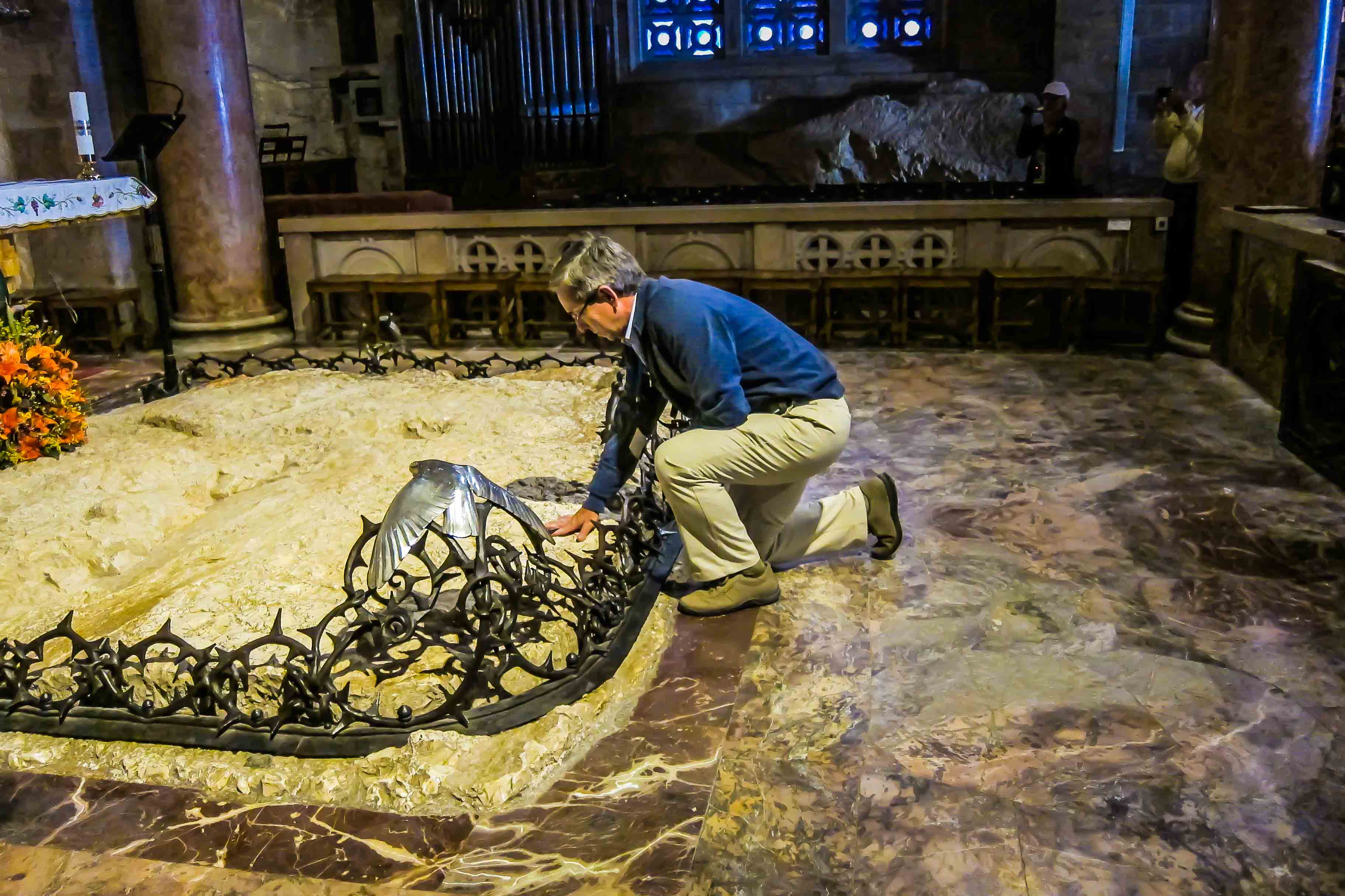
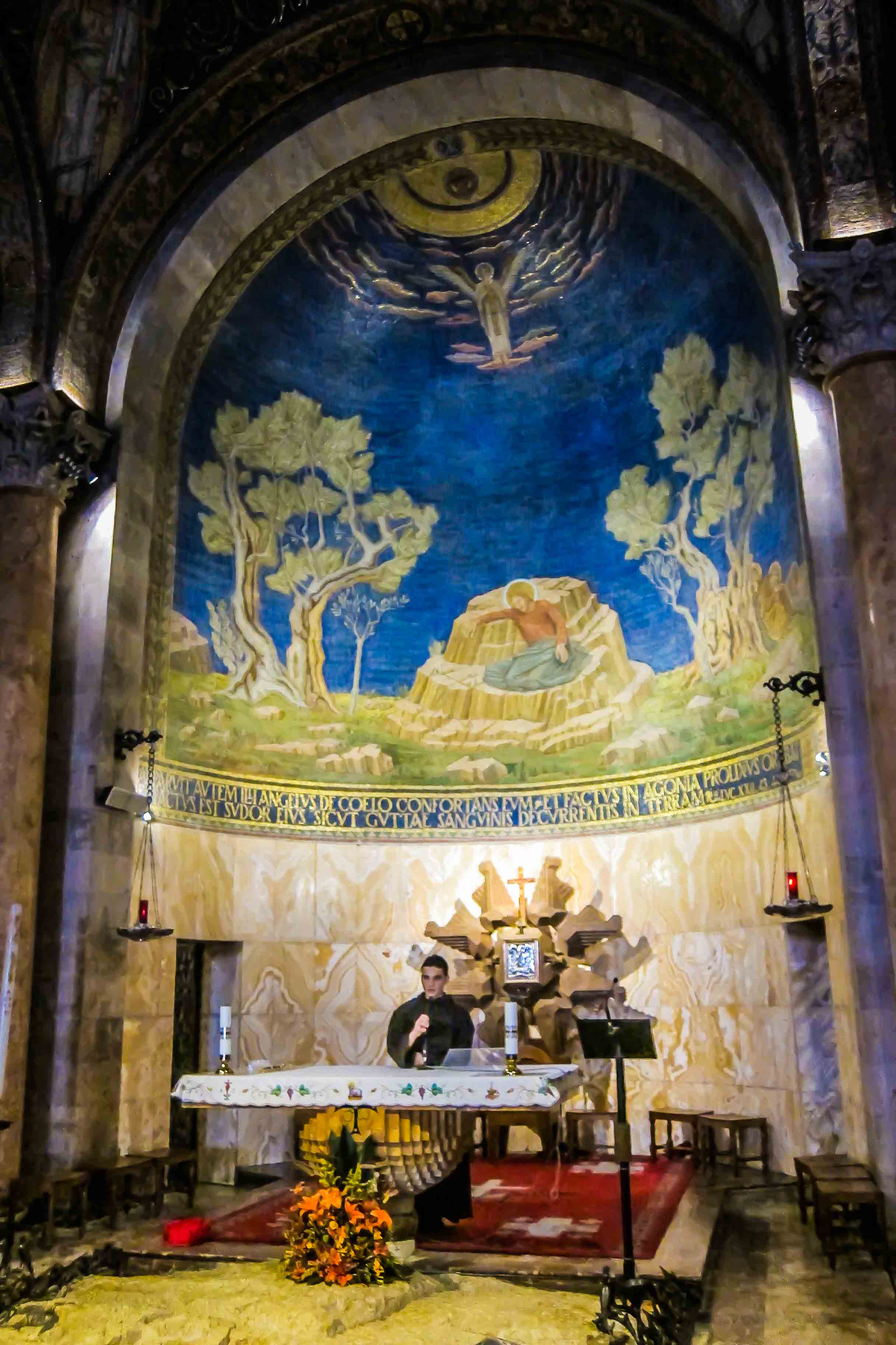
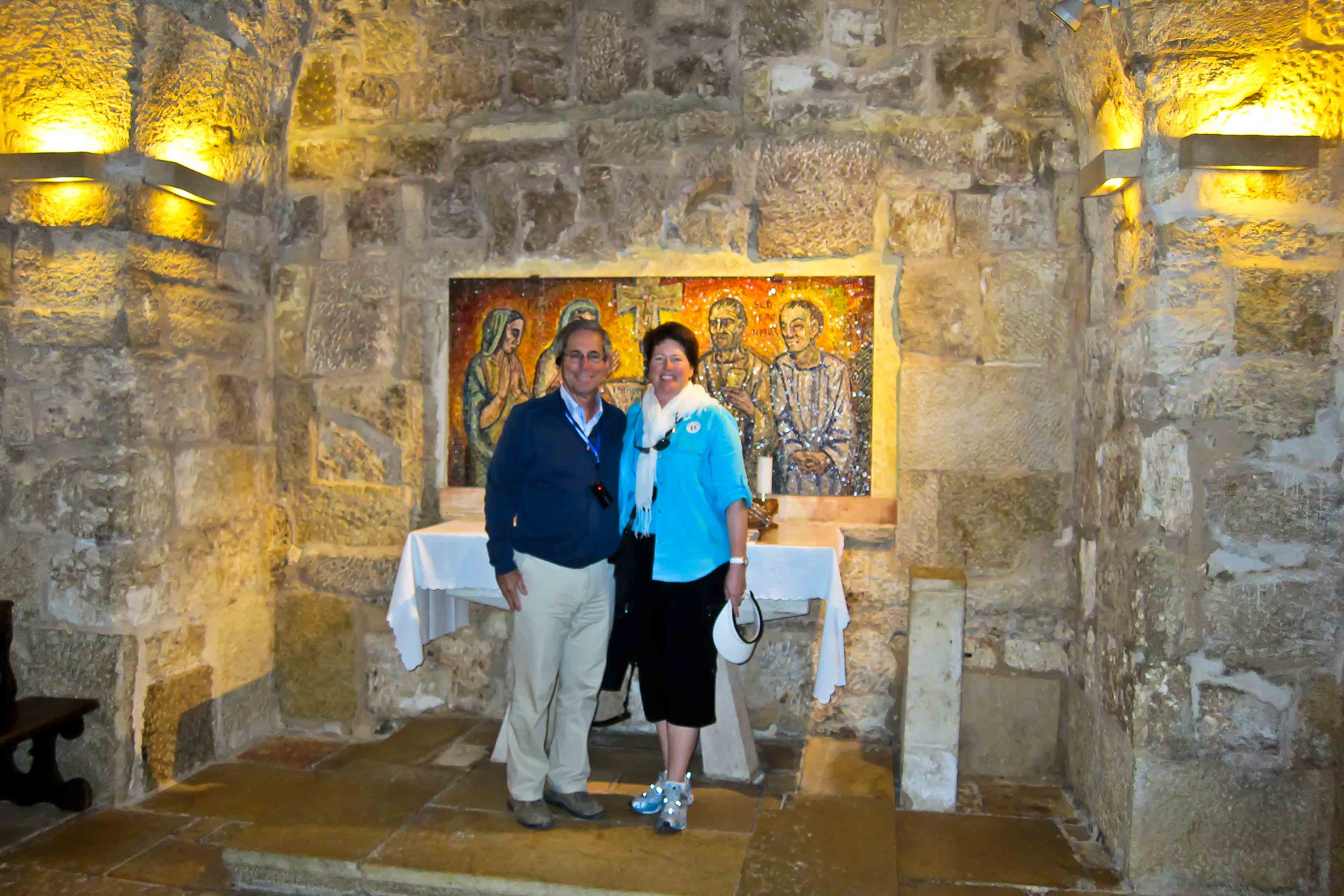
We next visited the Church, also known as the Church or Basilica of the Agony.  This is a Roman Catholic Church that enshrines a section of bedrock where Jesus is said to have prayed before his arrest.  Dale was able to go to the altar and touch the rock while I snapped the picture!

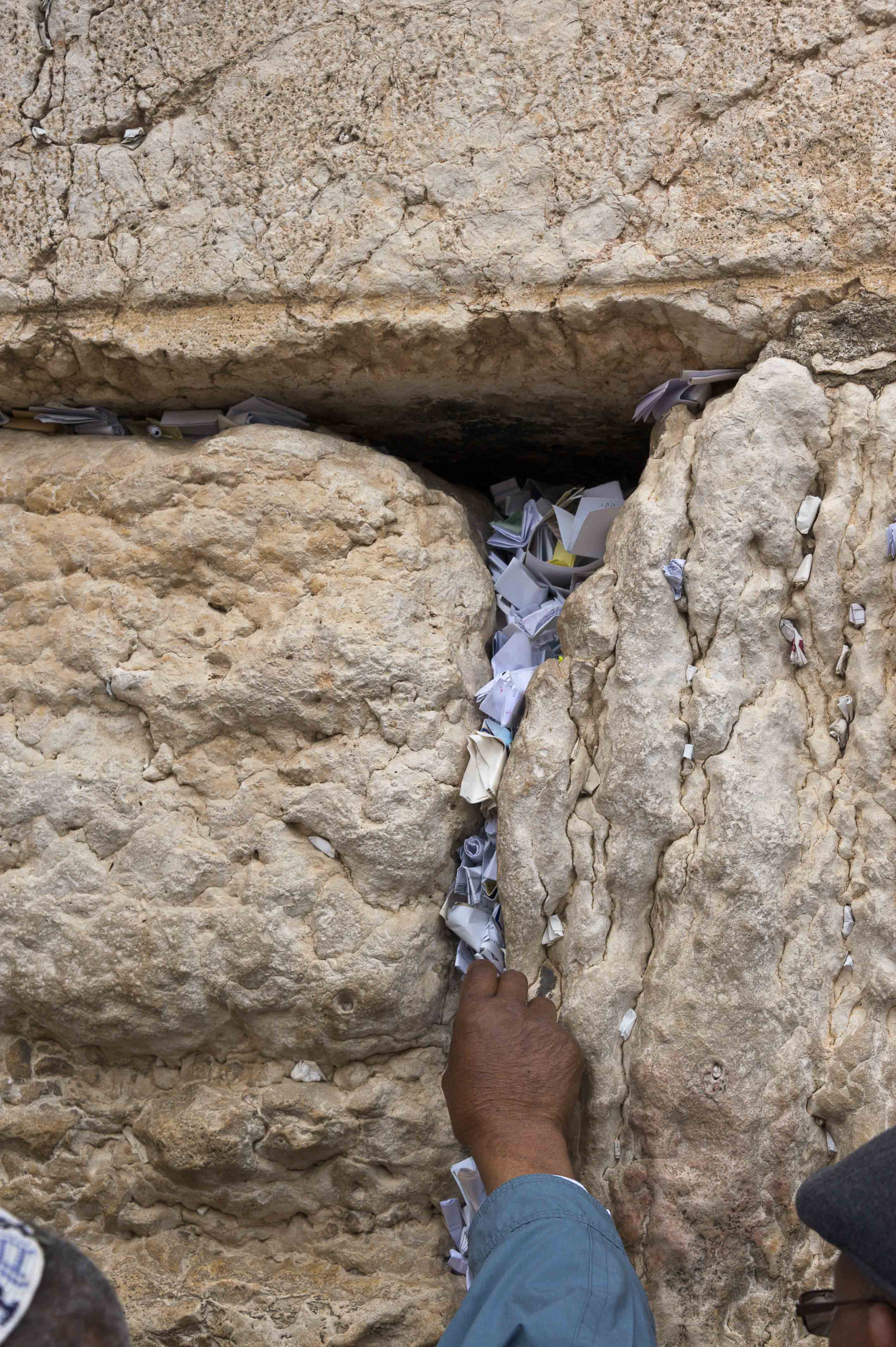
Back on the bus we had a short drive to the old city of Jerusalem.  After disembarking, our first stop was at the Wailing Wall.  The Wailing Wall is a sacred place for Jews and others, who often pray, and sometimes wail.  They slip prayers written on paper through the wall’s welcoming fissures.  It was a pretty intense scene especially since it is the last day of Passover and there are a large number of Jewish pilgrims visiting the old City.

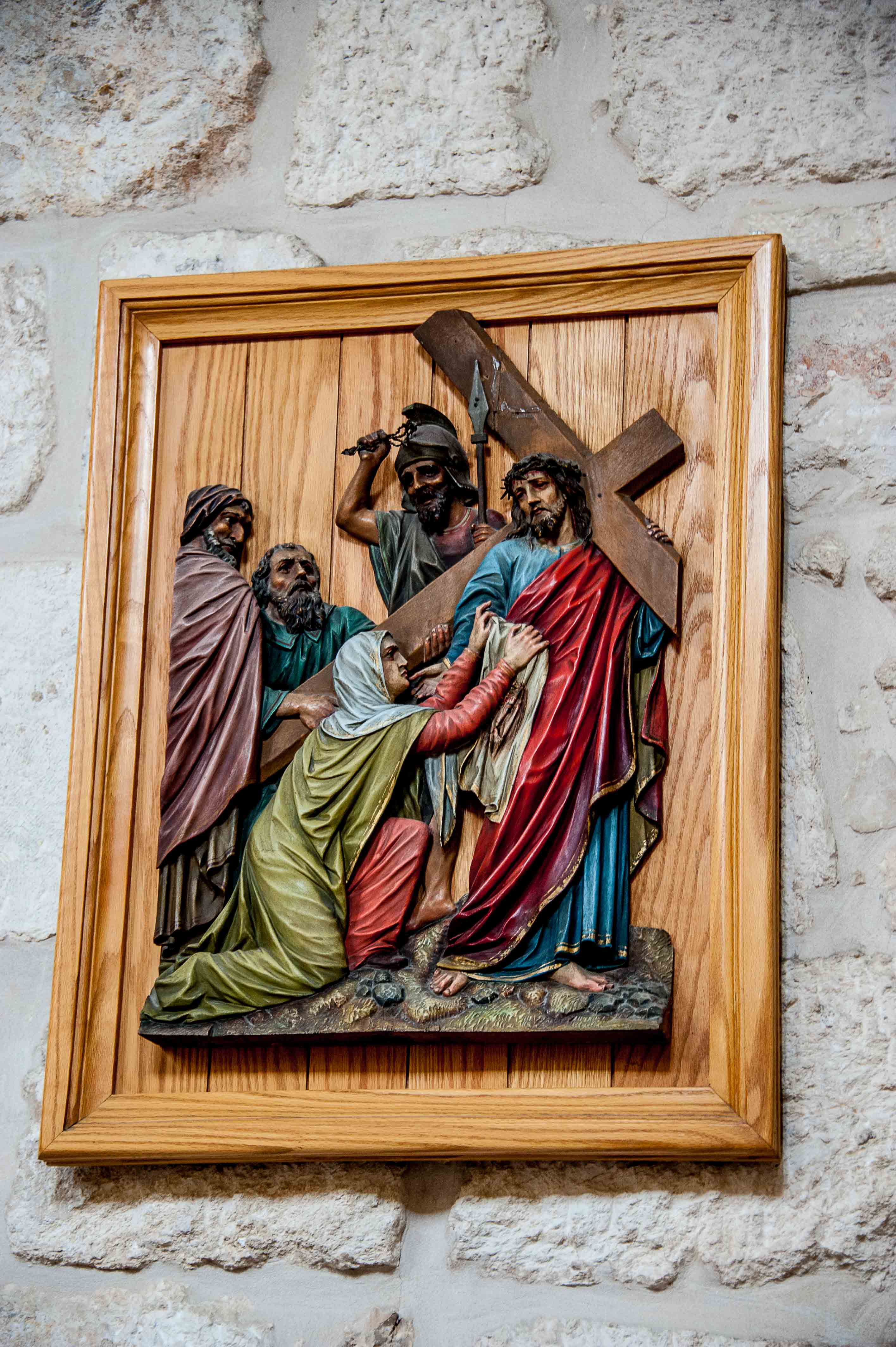
Our next adventure was to walk through the old city on the Via Dolorosa.  This is believed to be the path that Jesus walked, carrying his cross, on the way to his crucifixion.  Our guide told us that normally the Via Dolorosa is so packed with people that you just get pushed along with the crowds.  Luckily today, even though it is a major holiday, the place was, according to the guide, almost empty.  It seemed pretty busy to us, but this being our first time here we really wouldn’t know!

At the end of the Via Dolorosa is the Church of the Holy Sepulcher.  This site is on the Hill of Calvary, where Jesus was crucified, and is said also to contain the place where Jesus was buried (the Sepulcher).  Since the 4th century, the church is for many Christians, the most important pilgrimage destination as it is also the purported site of the resurrection of Jesus.

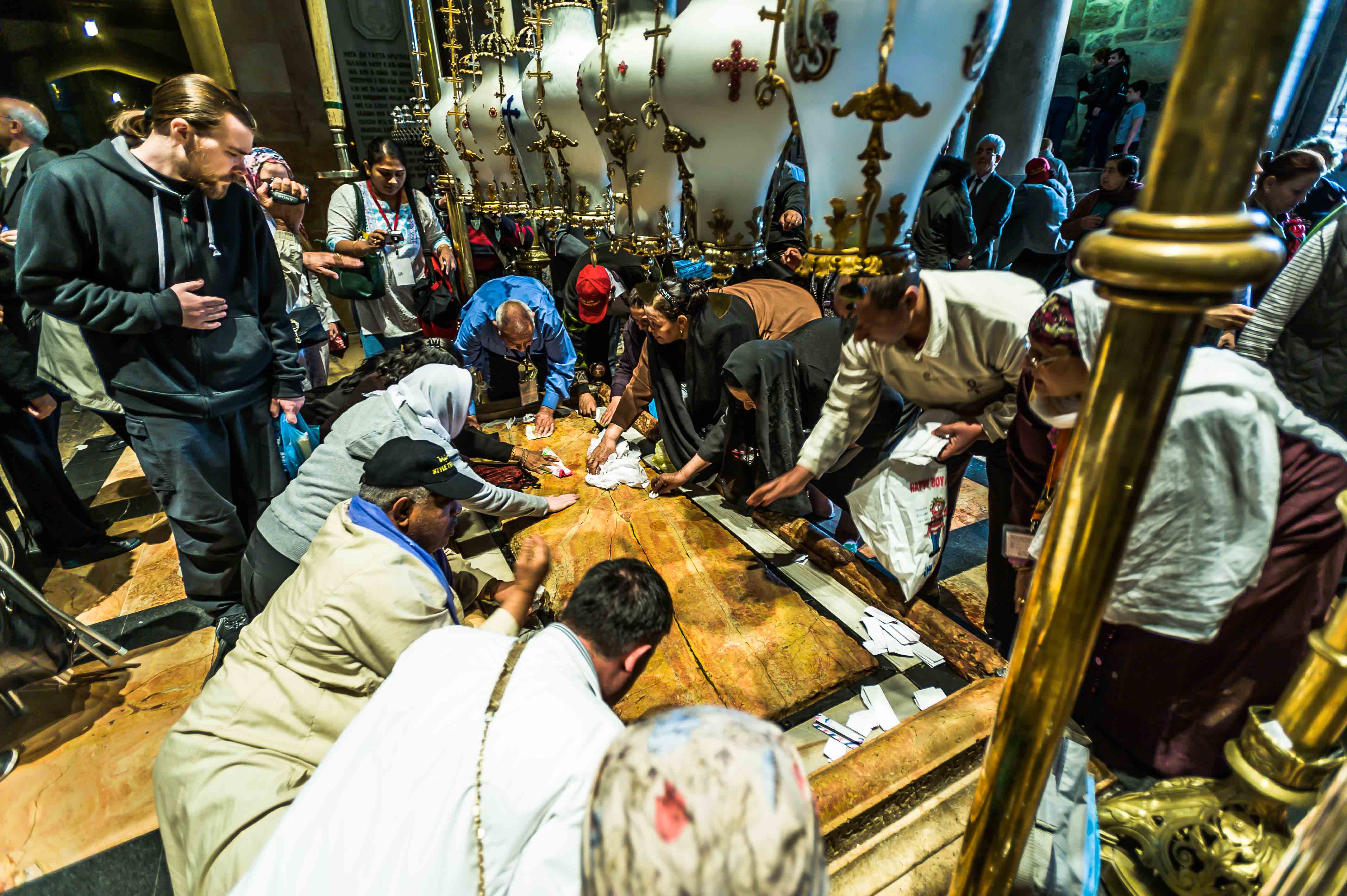
The Church was incredible and we witnessed some amazing scenes, including the Stone of Anointing, which tradition claims to be the spot where Jesus’ body was prepared for burial.

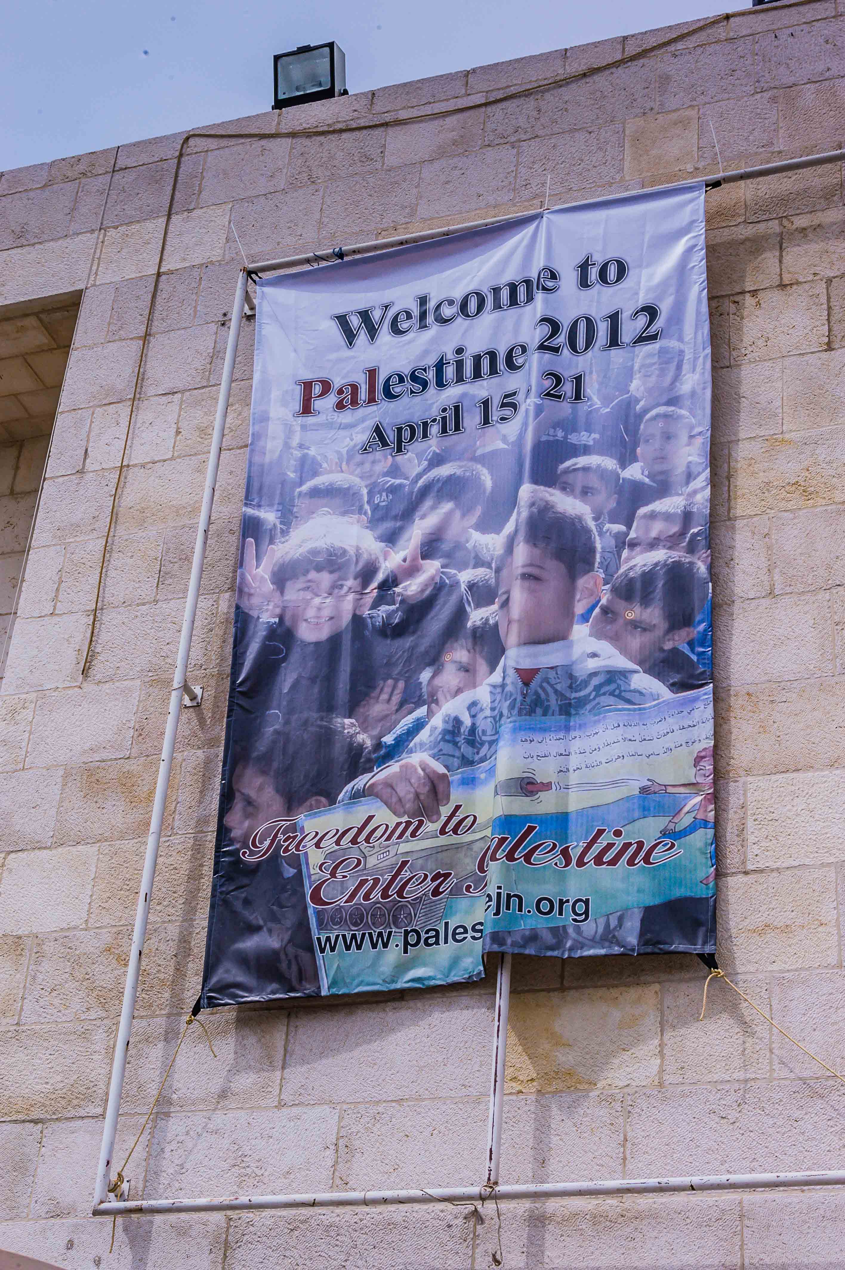
We were then driven to a hotel named Kibbutz Ramat Rachel which was a communally managed facility where we had a nice buffet lunch.  Our next stop is Bethlehem, which is a Palestinian city of approximately 30,000 people, located in the central West Bank approximately 5 miles south of Jerusalem.

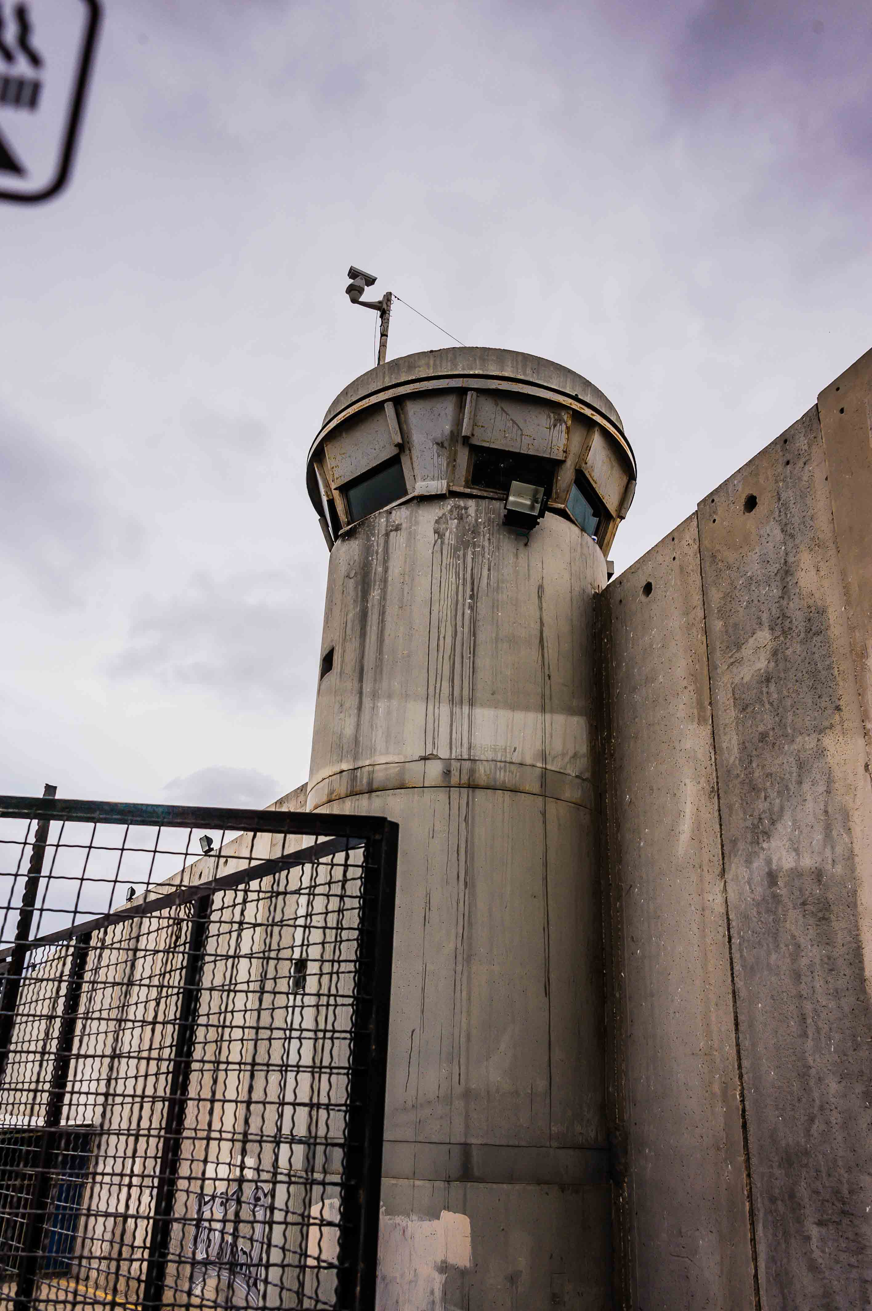
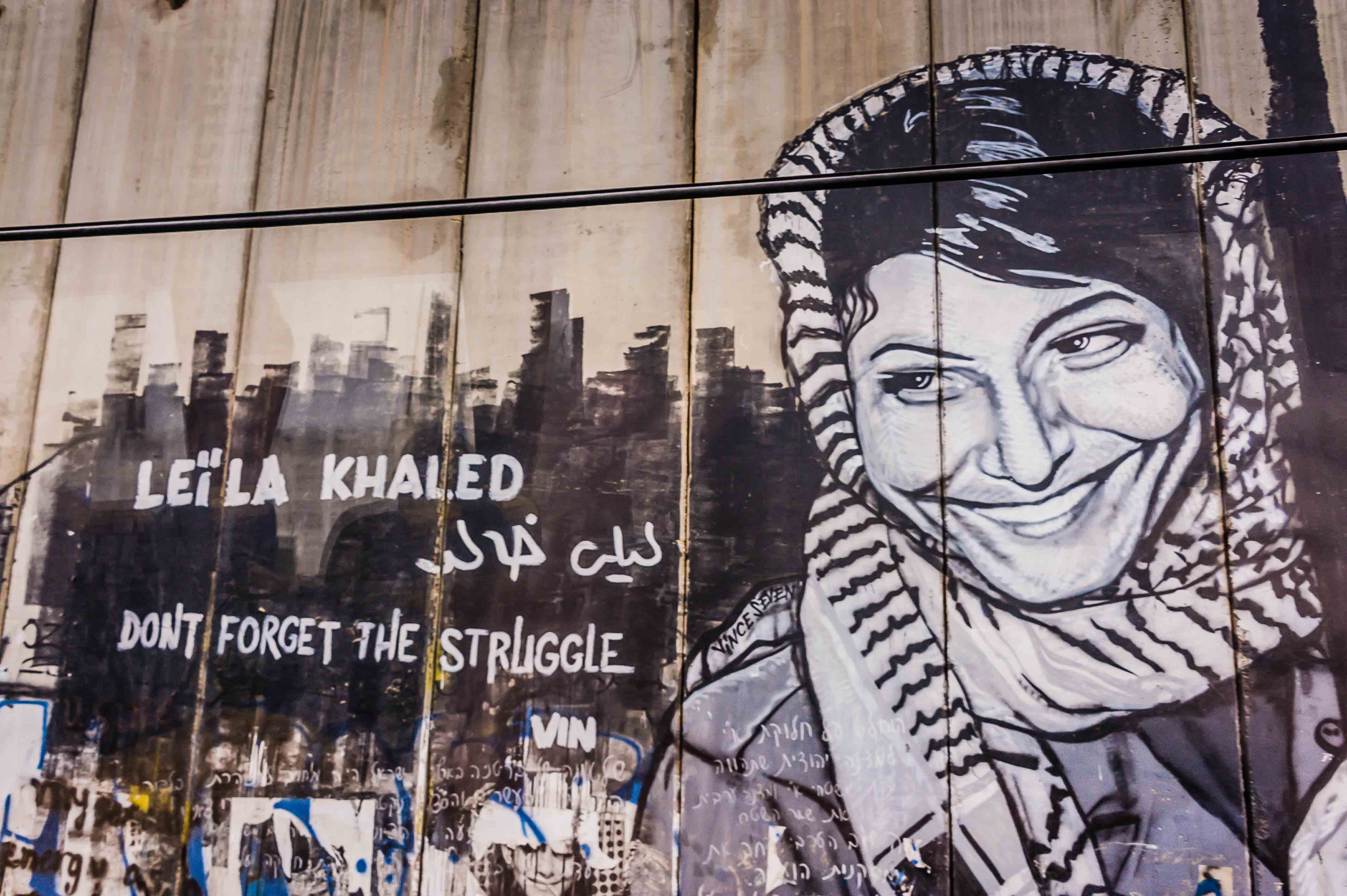
The Hebrew Bible identifies Bethlehem as the city David was from and the location where he was crowned as the king of Israel. The New Testament identifies Bethlehem as the birthplace of Jesus of Nazareth. The town is inhabited by one of the oldest Christian communities in the world.  To get into Bethlehem we had to pass through a heavily gated and guarded entrance.  The Palestinians control the West Bank and Bethlehem is located therein, which is why it is so heavily guarded.  Our Israeli guide stayed with us, but we took on a Palestinian guide who remained with us as we toured the area.

Our bus dropped us off outside the Church of the Nativity, which is our primary destination.  The Church of the Nativity is one of the oldest continuously operating churches in the world. The structure is built over the cave that tradition marks as the birthplace of Jesus of Nazareth, and is considered sacred by Christians.

The main Basilica of the Nativity is maintained by the Greek Orthodox Patriarchate of Jerusalem.  The basilica is entered through a very low door, called the “Door of Humility.” The original Roman style floor has since been covered over, but there is a trap door in the modern floor which opens up to reveal a portion of the original mosaic floor.

There is also an Armenian Orthodox Church here as well as the Roman Catholic Church of St. Catherine.  This is the church where the Latin Patriarch of Jerusalem celebrates Midnight Mass on Christmas Eve.  This ceremony is broadcast to Christians worldwide.

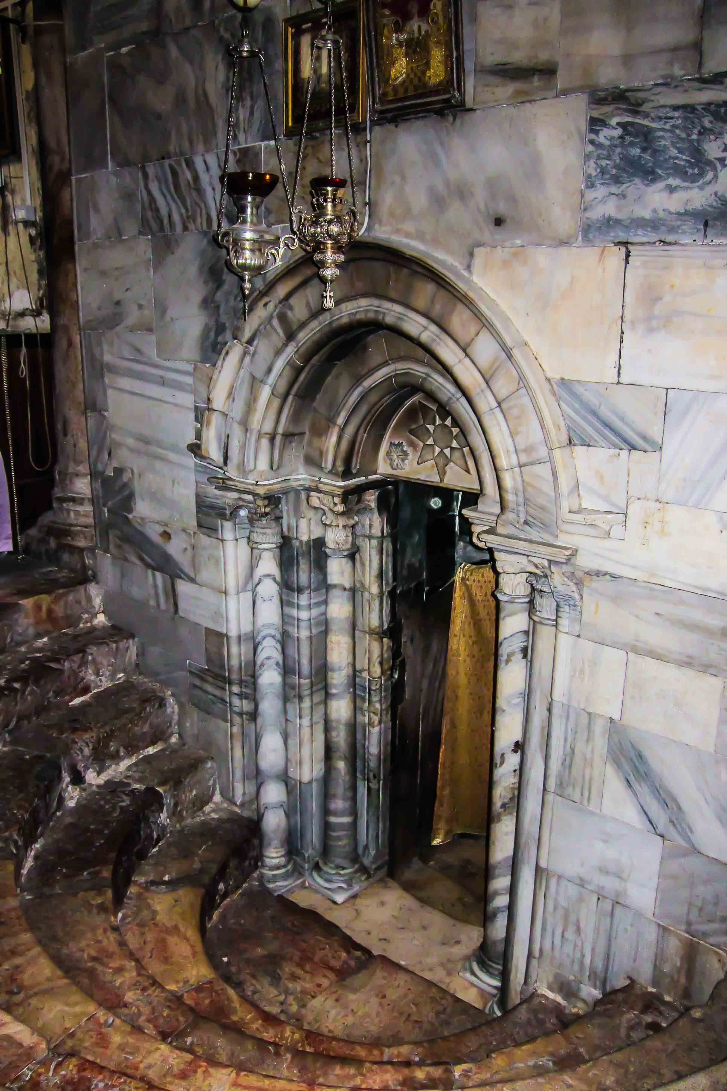
Underneath the churches is the Grotto of the Nativity.  It is an underground cave located beneath the basilica, the site where Jesus is said to have been born. The exact spot is marked beneath an altar by a 14-pointed silver star set into the marble floor and surrounded by silver lamps. This altar is considered religiously neutral.  Another altar in the Grotto, which is maintained by the Roman Catholics, marks the site where Mary laid the newborn Baby Jesus in the manger.

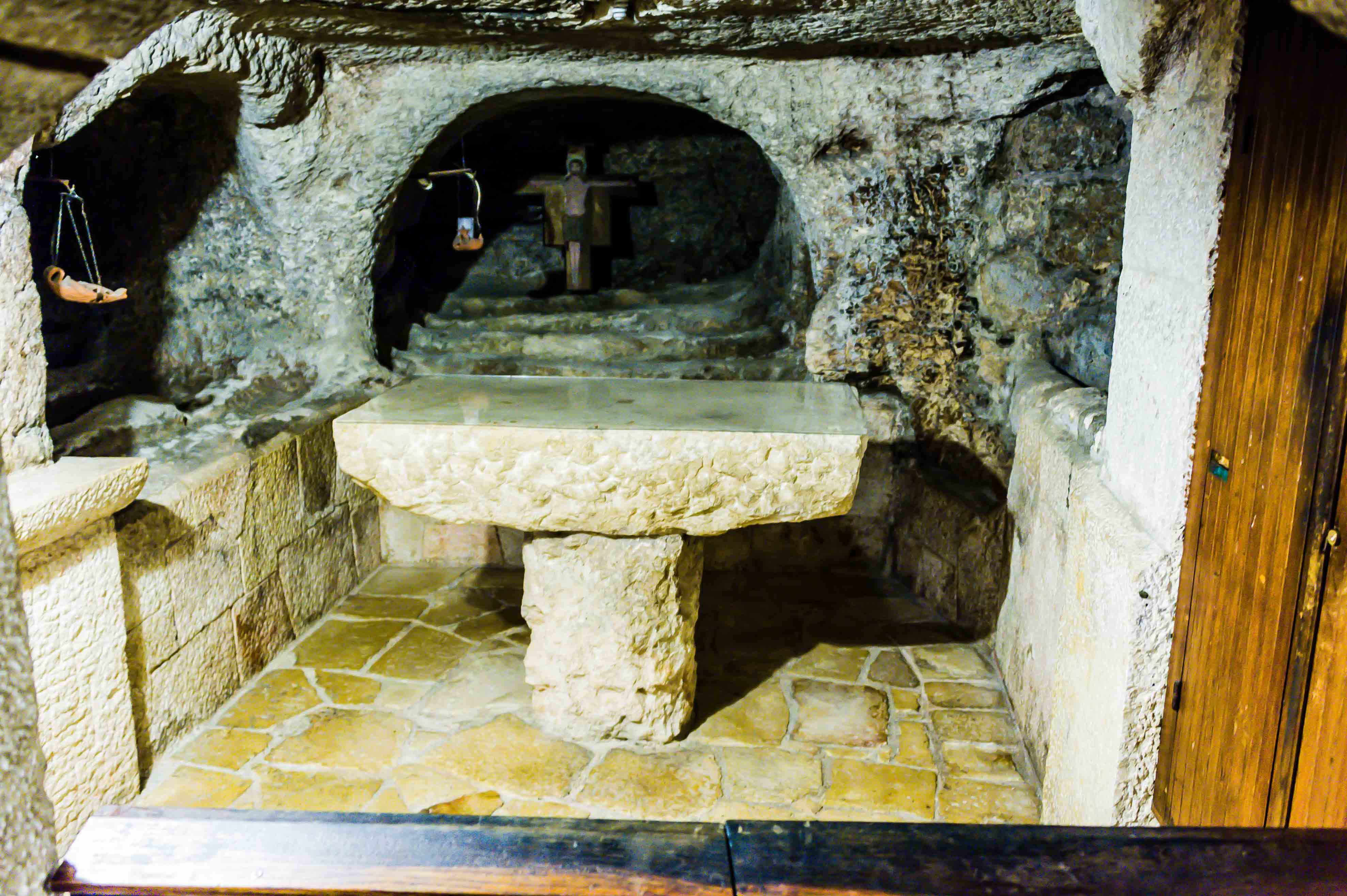
Our guide told us the wait to get into the Grotto of the Nativity would take over 3 hours, so he took us to an adjoining cave area located under the St. Catherine church.

The smooth limestone stairs down into the grotto were narrow and the ceiling was low.  Once inside, we could see the Chapel of the Innocents, the burial site of some of the young victims of Herod’s Slaughter of the Innocents.

The irregularly shaped grotto is hollowed out of rock and our guide had us walk down a narrow path were we could look through a peep hole in a wooden door to see inside the Grotto of the Nativity!  It was hard to see much, but I did see candlelight and lots of people standing around the room.

Back on the bus, we stopped at a store where we purchased some souvenirs and then took the 90-minute drive back to the ship.  Needless to say, this is an amazing place.  The convergence of Religion here is overwhelming.  It’s extraordinary and something we will never forget.

Because of the number of things we saw and the plethora of pictures I have split the galleries into two sections both for the Top Pictures Galleries and the SmugMug Galleries.

Top Pictures Gallery from Jerusalem:

To view all Pictures Gallery from Jerusalem click here.

Top Pictures Gallery from Bethlehem:

To view all Pictures Gallery from Bethlehem click here.


Facebook Share|Tweet Post|Email Post|Contact Me

The Suez Canal, also known by the nickname “The Highway to India”, is an artificial sea-level waterway in Egypt, connecting the Mediterranean Sea and the Red Sea.  It allows transportation by water between Europe and Asia without the need to navigate around Africa.

Here is the Top Picture Gallery for the Suez Canal:

Click here for the complete Picture Gallery for the Suez Canal.

There is one shipping lane and two passing areas. On a typical day, three convoys transit the canal, two southbound and one northbound. The first southbound convoy enters the canal in the early morning hours and proceeds to the Great Bitter Lake, where the ships anchor out of the fairway, awaiting passage of the northbound convoy. The northbound convoy passes the second southbound convoy, which moors in Ballah-Bypass. The passage takes between 11 and 16 hours at a speed of 8 knots (9 mph).

The low speed helps prevent erosion of the canal banks by ships’ wakes.  Unlike the Panama Canal, that has multiple locks to properly maintain the sea level between the Atlantic and Pacific Oceans, the Suez Canal contains no locks so seawater flows freely through the canal.

During construction there was much controversy about the level of the seas on both sides of the proposed canal.  It was speculated, that if they were wrong, all of the water from the Mediterranean would flow into the Red Sea (or vice versa) and the earth would tilt on its’ access due to the massive weight shift associated with the water flow.  This would, of course, destroy the world.  Needless to say they carefully took the measurements multiple times!

The digging of the canal took approximately 10 years using mostly forced (slave) Egyptian workers. Some sources estimate that over 30,000 people were working on the canal at any given period, that altogether more than 1.5 million people from various countries were employed, and that thousands of laborers died on the project.  While there was much controversy about the canal at the time, it became operational in 1869.

The canal is owned and maintained by the Suez Canal Authority (SCA) of the Arab Republic of Egypt. Under international treaty, it may be used “in time of war as in time of peace, by every vessel of commerce or of war, without distinction of flag.”  While the Canal has been closed during war time, including briefly during WWI and then again during the Arab-Israeli wars of 1967 and 1973, it has widely remained open.

Between 2008 and 2010, it is estimated that the canal has lost 10% of traffic due to the threat of piracy (Somalia), and another 10% due to the financial crisis. An oil tanker going from Saudi Arabia to the United States has 2,700 miles longer to go when taking the route south of Africa rather than the canal.

The Voyager was the lead vessel in a convoy of 20 ships heading north today.  It was slow, steady going but it was nice to be in first place along the way!  In general, the surroundings were surprisingly green, but then there is a lot of water available along the way.  We passed by some memorials and a bridge or two, plenty of what appeared to be small military or security outposts but otherwise it was a fairly uneventful crossing.  Uneventful is fine with us in this part of the world!

Facebook Share|Tweet Post|Email Post|Contact Me

We are back in Egypt today and ready for another long day off of the ship.  Almost everyone on the ship is getting off this morning and there were long lines to get our tour tickets as well as to disembark the ship.

Paul and Kathy had a private tour again today and had asked if we wanted to join them.  We had already bought tickets to go on the “Classical Cairo” bus tour with about 200 other guests…but when we saw the gaggle of people and learned that their mini-bus had plenty of room for us, we bailed on the bus and opted for another adventure with Paul and Kathy!

Here are the Top Pictures for Cairo:

Click here for the detailed Picture Gallery for Cairo.

With a population of approx. 7 million spread over 175 sq miles, Cairo is by far the largest city in Egypt. With an additional 10 million inhabitants just outside the city, Cairo is the center of the largest metropolitan area in Africa and the eleventh-largest urban area in the world.

While Cairo’s economy was ranked first in the Middle East, they have suffered lately due to the political unrest in this area.  Our guide, Usama, told us that tourism is down 80% from last year.  Even though tourism is down, the traffic in the city was still intense.

We started our tour with a 2 ½ hour drive from the Port of Suez to downtown Cairo and the pyramids!  The Giza Necropolis includes the Great Pyramid of Giza, which is one of the oldest and largest of pyramids in Egypt, as well as 8 other pyramids.

The Great Pyramid is the oldest of the Seven Wonders of the Ancient World, and the only one to remain largely intact. Egyptologists believe that the pyramid was built as a tomb for fourth dynasty Egyptian Pharaoh Khufu over a 20-year period concluding around 2,560 BC.

The Great Pyramid was the tallest man-made structure in the world for over 3,800 years. Originally, casing stones that formed a smooth outer surface covered this Pyramid; what is seen today is the underlying core structure.

It consists of approximately 2.3 million limestone blocks weighing 2-80 tons each!  Historians believe that the blocks were transported from nearby quarries. The Tura limestone used for the original exterior casing was quarried across the river. The largest granite stones in the pyramid, found in the “King’s” chamber, weigh 25 to 80 tons and were transported from Aswan, more than 500 miles away.

Traditionally, ancient Egyptians cut stone blocks by hammering wooden wedges into the stone, which were then soaked with water. As the water was absorbed, the wedges expanded, causing the rock to crack. Once they were cut, they were carried by boat either up or down the Nile River to the pyramid.  It is estimated that 5.5 million tons of limestone, 8,000 tons of granite (imported from Aswan), and 500,000 tons of mortar were used in the construction of the Great Pyramid.

There is a LOT of information on the Great Pyramid that you can find online so I won’t go into any more detail here…but needless to say, it’s massive and a real thrill to see in person.

There area around the Great Pyramid, known as the Giza Necropolis, is a complex of ancient monuments including three pyramid complexes known as the Great Pyramids, the massive sculpture known as the Great Sphinx, several cemeteries, a workers’ village and an industrial complex.  It is located 5 miles inland into the desert from the old town of Giza on the Nile, approximately 15 miles southwest of Cairo city center.

The weather was nice today, except for a strong breeze that not only made our hats blow off, but also blew sand in our eyes.  Paul and Kathy took a camel ride and Dale and I watched and took pictures and videos.  I am still apprehensive about getting on a Camel…they get down on their knees so you can climb on, and then, when they get up it is a rocky ride!

After visiting the various Pyramids and the Sphinx, we went to lunch at a nearby hotel and planned our afternoon.  Paul, the shopper, wanted to go shopping (go figure) and Dale, Kathy and I wanted to go to the Egyptian Museum to see, among other things, the contents of King Tut’s tomb.

So we decided that we would drop Paul off at the market area and head over to the museum.  Dropping Paul off turned out to be a bigger effort than originally expected…the traffic was thick so it was slow moving.

The tour guide was concerned about leaving him, but they verified that they had each other’s cell phone numbers and we left him in an area of town that I wasn’t even comfortable driving through, never mind shopping in.

On our drive to the museum we passed the Citadel and the Mohammad Ali Mosque. Situated on the summit of the citadel, this Ottoman mosque, the largest to be built in the first half of the 19th century, is, with its animated silhouette and twin minarets, the most visible mosque in Cairo. The mosque was built in memory of Tusun Pasha, Muhammad Ali’s oldest son, who died in 1816.

This mosque, along with the citadel, is one of the landmarks and tourist attractions of Cairo and is one of the first features to be seen when approaching the city.

Twenty-five minutes later we were at the Egyptian Museum and had a quick visit.  The Egyptian Museum contains many important pieces of ancient Egyptian history. It houses the world’s largest collection of Pharaonic antiquities, and many treasures of King Tut.

The Tut exhibit was fantastic.  The details on his coffin, his jewelry and the precision involved in building the complicated burial pieces was incredible.  Tut’s tomb contained four gilded shrines nested one inside the other in order of decreasing size. Inside the innermost shrine was a red quartzite sarcophagus which protected three anthropoid coffins (man-shaped). The first two coffins were made of gilded wood but the final coffin was made of solid gold. The solid gold coffin housed the mummy of King Tut and his fabulous golden death mask. We got to see all of this, including his actual tomb and mummy when we were in Luxor at the Valley of the Kings.

During the Egyptian Revolution of 2011, the museum was broken into, and two mummies were damaged and several other artifacts were destroyed.  Also during that time the ruling party headquarters building next door to the museum was set on fire but luckily did not damage the museum.  We were shocked when we saw it…the building is huge and right next-door to this important museum.

Back in the van we were off to pick up Paul only there was one problem…Paul’s cell phone didn’t seem to be working.  So we headed to the pre-arranged meeting area and waited while the guide continued to try and reach him.  After thirty minutes passed we were able to connect with him and he was back in the van a few minutes later.  Thank goodness!

The drive back to the port was uneventful and we were surprised to see a huge contingent of the ship’s crew out on the dock waiting to greet us!  The band was playing and we were welcomed back in grand style, leaving Egypt behind us, as we get ready to cross through the Suez Canal tomorrow.

Facebook Share|Tweet Post|Email Post|Contact Me
  • April 11, 2012 - 7:50 pm

    Sherrue - Margaret & Dale,

    We’re really enjoying your blog and photos. It brings back such fond memories of our last voyage to that part of the world with Pauline & Herb. Can’t believe you did the Donkey’s in Petra. . . you are brave souls.
    continue to have fun and travel safe.
    Sherrie & NickReplyCancel

  • April 12, 2012 - 2:51 pm

    Cheryl - Ok… so I was just complaining about pushing 2 little girls and a stroller with library books weighing about 80 lbs. Hmmm… I guess I’ll have to go back and rethink my complaints! Absolutely Amazing information. Thanks so much… Wish I was there with you both!ReplyCancel

  • April 12, 2012 - 2:57 pm

    Cheryl - I can’t figure out how to leave messages on some of your photos. But… I just am loving all of them. I wonder if your lives will ever be the same after this trip. It must make you look at life differently! 🙂ReplyCancel

Today we arrived in Sharm el Sheikh, the “City of Peace”, which is situated on the southern tip of the Sinai Peninsula at the most of the Gulf of Aqaba in Egypt.  While it has had a rather chaotic history over the past 60 years, having been taken over a couple times by Israel, it is now a resort town that also has become a major port and naval base for the Egyptian Navy.

It is also a good jumping off point for a trip to St. Catherine’s Monastery and Mt. Sinai, a famous mountain in the bible, namely, where Moses received the 10 Commandments on stone tablets.

Today Margaret decided to stay on the ship as the trip we had planned is a very long bus ride across the desert to St. Catherine’s Monastery.  Even Paul and I questioned whether we should go but, in the end, we jumped on the bus and went out hoping to get a picture of Paul carrying down the 10 Commandment tablets just like a modern day Moses.

Here are the Top Pictures for today:

Click here for the detailed Picture Gallery for today.

San Catherine’s Monastery, commonly known as Santa Katarina has the official name of Sacred Monastery of the God-Trodden Mount Sinai at the mouth of a gorge at the foot of Mount Sinai.  It is Greek Orthodox and a UNESCO World Heritage Site.  It was built between 548 and 565 and one of the oldest working Christian monasteries in the world.  It has become a favorite pilgrimage site.  According to tradition, Catherine of Alexandria was a Christian martyr sentenced to death on the wheel. When this failed to kill her, she was beheaded. According to tradition, angels took her remains to Mount Sinai. Around the year 800, monks from the Sinai Monastery found her remains.

The monastery was built by order of Justinian I enclosing the Shapel of the Burning Bush which was ordered to be built at this location by Helena, the mother of Constantine I at the site where Moses is supposed to have seen the burning bush and sure enough, the burning bush is still there today!  Like other famous places in the middle east, the site is sacred to Christianity, Islam and Judaism.  An interesting thing for budding architects is that the king post truss in the main building is the oldest known surviving roof truss in the world.  I guess they don’t build them like that any more.

The bus ride was just over 4 hours through parched desert.  Margaret definitely wouldn’t be too excited about that, not to mention that it was going to be another 4 hours to get back to the port.  Ugh!  There was an inspection as we left the port, one when we arrived at St. Catherine’s and same on the return.

When we arrived there were a number of young boys hawking camel rides which were about $5.  I decided to walk TO the monastery which was a couple blocks and then ride a camel back.  There was a line of tourists outside the monastery and we queued up for about a 15 minute wait to go through the small doorway into the monastery.  We went into the church

There is an Orthodox Church that was ornately decorated…lots of hanging gold stuff, stained glass windows but overall very dark.  They didn’t let us take pictures inside.  There is also a library that preserves the second largest collection of early manuscripts in the world, outnumbered only by the Vatican Library!  It contains Greek, Arabic, Armenian, Coptic, Hebrew, Gerorian and Aramaic texts as well as ancient artworks including beautiful mosaics.  One interesting document was created by Muhammad which bestows his protection on the monastery, one of the reasons that it has survived for such a long time.

After taking a walk around the monastery Paul and I headed up the steep hills across the road to simulate Moses bringing down the 10 Commandment tablets.  It also provided a nice overview of the walled compound and let us stretch our legs before the long bus ride “home”.  I took a camel ride back to the bus and had a good time with my guide who also took a picture of me.

On the way back, I worked on the blog on my MacBook and Paul fell asleep on the back seat of the bus.  In the end, it was questionable whether it was worth it but we did see a part of the world that few get to see.

Facebook Share|Tweet Post|Email Post|Contact Me

Happy Easter everyone!  This was one of the most amazing days we’ve had so far on this trip, and that’s saying a lot!  We decided to take a private tour with our new friends Paul and Kathy to the ancient city of Petra.

We left the Port of Aqaba at 9:00 am and drove 2 hours to the city of Petra.  We have a driver and guide today and even though our tour guides’ name was Jehad, Paul decided to call him John.  I guess he didn’t want to call out “Jehad” which sounds very similar to “Jihad” in crowded Muslim areas!  Probably a good idea.

Petra is a historical city in Jordan established around the 6th century BC as the capital city of the ancient Nabataean people.  it is the primary symbol of Jordan as well as its most visited tourist attraction.   It is famous for its rock-cut architecture and water conduit system.

Petra lies on the slope of Mount Hor in a basin among the mountains that form the eastern flank of Arabah (Wadi Araba), the large valley running from the Dead Sea to the Gulf of Aqaba. Petra has been a UNESCO World Heritage Site since 1985.  We drove bout 1.5 hours through desert that looked somewhat similar to some of the desert areas northeast of Los Angeles seeing shepherds guiding their flocks, stopping at a store to look for a hat for Paul (he tends to lose them from time to time) and stopping a couple times just to admire the scenery and take some pictures.  Finally we saw the entrance to Petra far below as we approached the reasonably populated city just outside the entrance gate.

This part of Jordan used to be a gateway for businessmen doing trade.  There is an area now called “Little Petra” just up the road (we would go there later in the day) that similarly was a passageway through sandstone.  Little Petra, however, was the place where business was done.  “Big Petra”, on the other hand, was a spiritually oriented place and a sacred burial place, with tombs built into the tall sandstone walls.  The Nabataeans created this “Siq” where an ancient river had carved through the sandstone.  The Nabataeans diverted the seasonal water that still flowed here with man-made dams to create a protected entrance to the area and then carved tombs from massive sandstone rock faces; it’s truly an awe-inspiring achievement and the detail is incredible.

After buying our entrance tickets, we walked by a Hyatt hotel which is partly built into the sandstone, walked by the typical shops selling local wares and entered the “park”.  Here you could catch a ride on a horse-drawn cart for the mile-long ride over dirt and rock-paved narrow roads through tall sandstone “cliffs”.  We decided to walk in on the fairly busy road getting a tour along the way from John.  The video below shows some carts going by on our walk in and then the ride we took on the way out.

When we got to the end of the walk through the high-walled chasm, called The Siq, we saw the Treasury.  This is the first and most incredible architectural component that you see at Petra.  It is breathtaking…absolutely incredible.

Once inside, we walked to an area where you can rent donkeys or camels to ride through the inner part of Petra.  We opted to take the donkey ride and had no idea what we had in store for us!  The video below shows what the camels looked and sounded like.

We all had Petra on our bucket list, but Paul also had on his to go to the Monastery at the top of 1,000 stairs, high up on the mountain. The donkeys seemed a good and fast way to get there.

The only downside of riding the donkeys to get to the Monastery is that you had to ride a donkey!  We’ve never ridden donkeys before and it is different than riding a horse…you can’t really “steer” a donkey (at least not these donkeys).  And, my donkey liked to be out front, so our guide (who was only 11 years old) kept yelling “Out of control! Out of control!”  I assumed he was speaking about the donkey and not me!

Soon after getting on our donkeys we passed by Judy and Franco riding Camels in the other direction.  I am not sure if Camels are easier to ride than donkeys but at least the donkeys are closer to the ground if you should happen to fall off!

As we continued through town, people needed to jump aside as we came trotting (sort of) through the crowds.  Our guide kept hitting my donkey on the rear to get him to move faster and all I could do was hang on.  Then, when we got to the stairs, the donkeys kept going right on up and we had to learn to not only hang on tight, but also lean as far forward as we could in order to get our center of gravity closer to the donkey’s head.  Pretty crazy especially when we got to areas where it was really steep, there were people and other donkeys sharing the same steps and sheer cliff drop offs!

We finally made it to the top of the mountain and got down off of our mounts.  That is when I learned that another guide had come down the stairs with 2 donkeys and basically squeezed Dale’s donkey off the path.  His donkey ended up sliding down a 6-foot drop off and Dale luckily hung on for the ride!

We had a 15-minute hike to get up to the Monastery and it was well worth the effort.  It’s another amazing example of the skill and persistence of the Nabataean people.

After taking some great pictures of the monastery, where both Dale and Paul scaled the wall to get up into the structure, Dale found a guy standing on his head and took a picture of him as well.  Pretty cool.

Now, riding donkeys up stairs is one thing…but riding them down stairs is even crazier!  After only a few minutes of riding, two donkeys coming down the stairs pushed Dale’s donkey (again) off the narrower steps onto some steeper ones.  When this happened the saddle slid to one side along with Dale!  His foot was caught in the stirrup, so he didn’t fall off all the way.  Luckily he only broke his camera lens hood and didn’t hurt himself.

After that excitement Kathy, Dale and I decided to walk down the stairs and Paul remained on his donkey.  He later told us there were at least two times when he was holding his breathe on the way down the stairs hoping he’d make it!

Back at the base we found our guide and decided to take horse-drawn carriages back through The Siq to get out to where our mini-van was waiting.  The Siq has some original areas that are covered with rugged stones making for a bumpy ride!  It was a LOT faster than walking and gave us some extra time in the small town area to look around.

Paul, being the pre-eminent shopper that he is, immediately went to investigate the shops while Kathy and I sought out cold beverages and found a cool bar called “the cave bar”.  While Dale went to tell Paul where we were, Kathy and I relaxed and relived our incredible Petra adventure.

While Paul shopped, the rest of us went to visit “Little Petra”.  It is believed Little Petra was an important suburb of Petra, the entry and exit point for the trade routes to the north and northwest. Here the caravans from the Negev, Gaza, Jerusalem, Egypt and the Mediterranean coast arrived, had a rest and engaged in trade. Like in Petra buildings had been carved into the sandstone, used as residences, storages and tombs, with water channels and cisterns. In one of the buildings you can find the remains of painted frescos with birds, grapes and flowers, dating from the 1st century AD.

After visiting Little Petra we drove back to town to pick up Paul and the ride back to the ship.  We were all happy and exhausted after our incredible Easter day in Petra.  It turns out riding the donkey was probably more work than if we’d actually just walked up on our own. Hindsight being what it is, we probably shouldn’t have taken the donkeys up the mountain, but we are glad that we did!

Here is the Top Picture Gallery for Petra:

Click here for the detailed Petra Picture Gallery.


Facebook Share|Tweet Post|Email Post|Contact Me